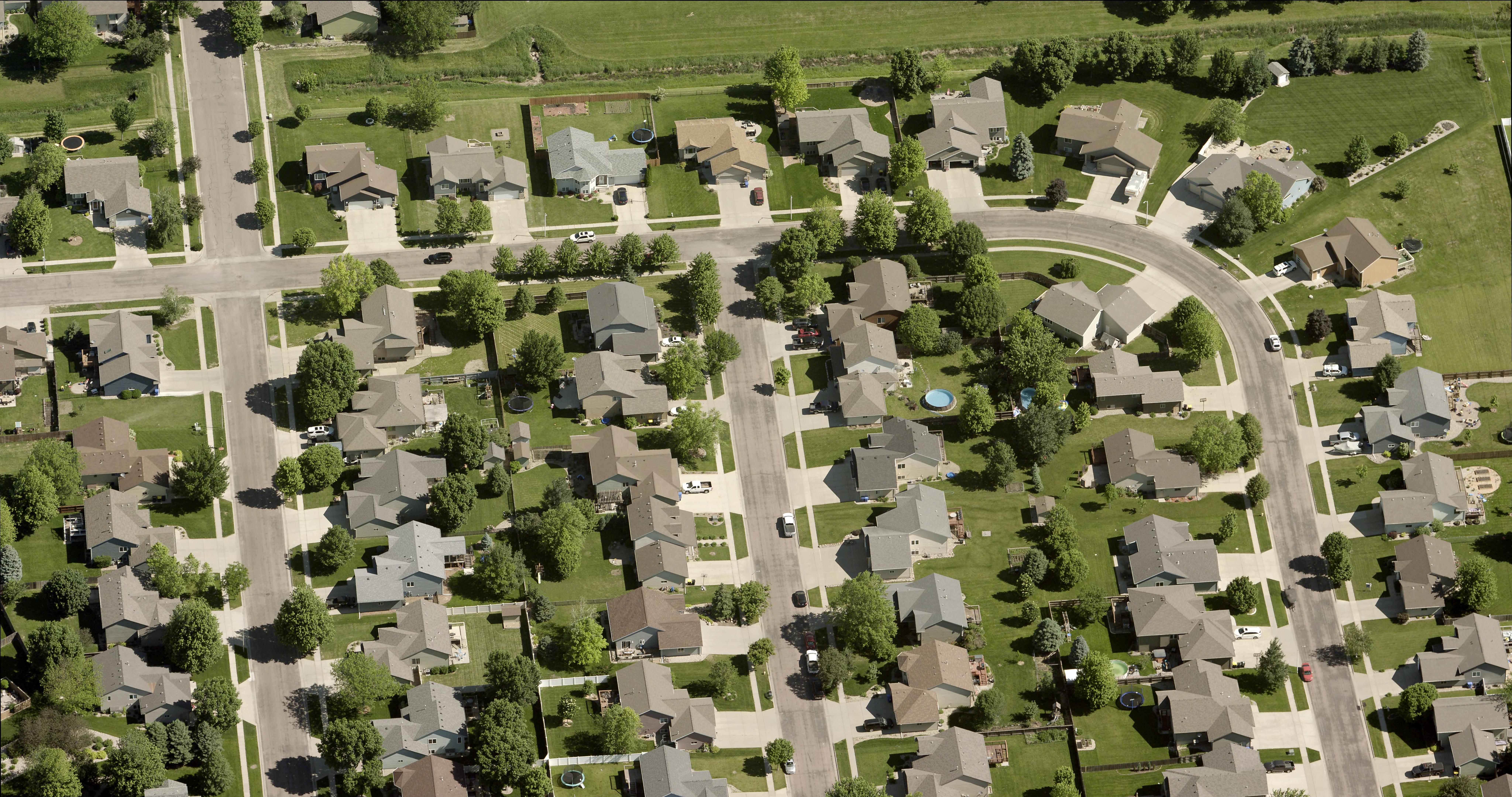
Technological advancements in aerial imagery have made it possible to capture and process images at a level of detail that was previously unattainable. EagleView has leveraged these innovations to scale the production of 1-inch Ground Sample Distance (GSD) imagery, making it accessible for state and local governments to use in a wide variety of applications. Over the past two decades, the resolution of aerial imagery has progressed significantly, from 1-foot resolution to 9-inch, 6-inch, 3-inch, and now, to the ultimate clarity of EagleView’s 1-inch GSD imagery. This progression allows government agencies to unlock a new level of precision, enhancing decision-making and operational efficiency across departments.
In this post, we’ll explore the technical aspects of GSD, its practical implications for government use, and why 1-inch GSD is the clear choice for those who need the best possible image quality.
Understanding GSD and Its Role in Image Clarity
Ground Sample Distance (GSD) refers to the distance between the centers of pixels in an aerial image as measured on the ground. In essence, GSD defines the size of the area on the ground that each pixel represents. Pixels are the smallest units of an image, and each pixel can only hold one value, representing brightness and color. This means that an entire pixel corresponds to a single value for a specific area, and the more pixels in an image, the more detail that can be captured. Therefore, a lower GSD results in more pixels and a higher resolution, which in turn increases the clarity and precision of the image.
To illustrate this, imagine an image with a 1-foot GSD. In this case, each pixel represents one square foot of the ground. Since a pixel can only have one color and one brightness value, that entire square foot will appear uniform in the image, regardless of any variation that may exist within the area on the ground. This limits the amount of visible detail. As GSD decreases and resolution improves, more pixels are added to represent the same area. This allows for greater differentiation of features within that space—small differences become clearer, and subtle details can be seen.

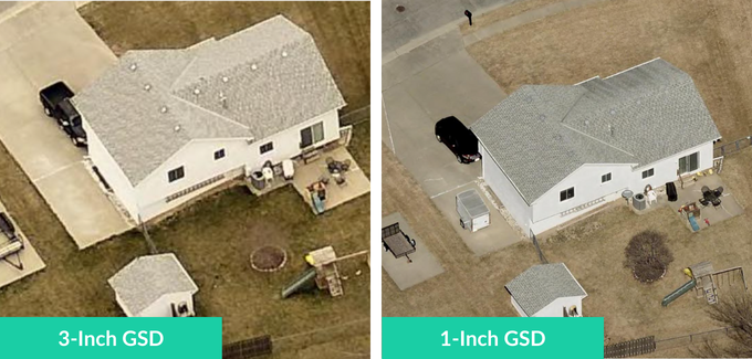
In the graphic, you can see how reducing GSD dramatically increases the amount of information captured. For example, an image with 1-inch GSD contains nine times the pixel data of a 3-inch GSD image. This means that for every pixel in the 3-inch image, there are nine corresponding pixels in the 1-inch image, allowing for much finer detail and clarity. The difference becomes even more pronounced when compared to larger GSDs, such as 6-inch or 1-foot, where significantly less data is available per unit area.
For state and local governments, this increase in resolution is critical. High-resolution imagery provides the necessary detail for tasks like infrastructure inspection, property assessment, and public safety planning. With 1-inch GSD, governments can make more informed decisions, reducing the need for field inspections and allowing for more efficient project planning from a desktop. The added clarity can reveal fine distinctions in infrastructure, vegetation, and property features that might be overlooked at lower resolution.

Why GSD Matters for State and Local Governments
Aerial imagery supports a range of government functions, from planning urban developments to maintaining infrastructure. The level of detail provided by 1-inch GSD imagery enables governments to identify even the smallest features — from the condition of pavement to the presence of invasive weeds. These images offer an unmatched level of clarity that improves the accuracy and efficiency of critical tasks, reducing the need for physical site visits and providing actionable data right from the desktop.
Some specific examples include:
- GIS professionals: Extract detailed mapping and planning data.
- Public works departments: Remotely conduct accurate asset management and sign inventory.
- Appraisers: Assess construction details and property features with confidence.
- Public safety officials: Evaluate road access, hazards, and structural details.
- Weed control divisions: Identify noxious weeds and plan for control measures.
Why EagleView’s 1-Inch Imagery Stands Out
EagleView is the only provider of 1-inch GSD imagery at scale, offering local governments unparalleled clarity and precision in their aerial imagery. This capability translates into measurable benefits, from improved decision-making to cost savings, as demonstrated by Douglas County, Nebraska.
Douglas County, NE: Precision and Cost Efficiency with EagleView
Since 2010, Douglas County (home to Nebraska’s largest city, Omaha) has utilized aerial imagery, beginning with 6-inch GSD and later transitioning to 3-inch GSD. When EagleView introduced 1-inch GSD, GIS Administrator Mike Schonlau recognized the value immediately. The enhanced clarity allowed the county to cut costs by reducing field visits, saving on fuel, labor, and vehicle maintenance, while also improving decision-making. According to Mike, “With 3-inch imagery, I was thrilled, but 1-inch truly takes it to the next level. We’re actually saving money because people are spending less time in the field.”


Webinar: The Business Case for Upgrading to 1-Inch Imagery
Watch as Mike Schonlau, GIS Administrator for Douglas County, NE, details the cross-departmental benefits of 1-inch imagery for his staff and residents and how to build a business case for it within your organization.
Watch the on-demand webinar
Achieve Greater Precision with EagleView’s 1-Inch Imagery
In state and local government, the decisions made today impact communities for years to come. With 1-inch GSD imagery from EagleView, you gain the clarity needed to make informed decisions, plan effectively, and manage infrastructure with precision.
Remember, the smaller the GSD, the greater the clarity. EagleView’s 1-inch imagery offers the highest resolution available, ensuring that your government teams have the data they need to succeed. Contact us to learn more about how 1-inch GSD imagery can transform your next project.