Sketch Verification: Increasing Efficiency & Revenue for Local Governments
Accuracy is essential when assessing properties for local government because the level of accuracy in your property data directly impacts your county’s tax revenue. The less accurate your records, the more likely it is you’re losing out on revenue.
Sketch verification solutions ensure your county captures maximum revenue while your assessment processes run as efficiently as possible. To explain how sketch verification works, we conducted a webinar titled Sketch Verification: The Key to Uncovering Lost Revenue and Boosting Assessment Accuracy. Check out the on-demand version of the webinar here.
The webinar shows how sketch verification enables assessors to identify untracked changes in local government records, pinpoint discrepancies, and more. We were joined by three experts in sketch verification and property assessment: Joe Oddi, Director of Partner Strategies, Government for EagleView; Wade Patterson, 2023 IAAO Immediate Past President; and Elliott Cox, Senior Product Manager at EagleView. Here’s a snapshot of what they reveal in the webinar:
Oblique v. Orthogonal Imagery
Joe provided visuals demonstrating how oblique imagery captures an image from a side angle whereas orthogonal imagery captures a top-down perspective. Both have their merits.
Oblique imagery gives you a greater understanding of a property by being able to see how many floors it has, determining if an addition is a porch or living space, and much more. It captures side angle views from all four cardinal directions, so you can see a building from all sides. In property assessment — where small details matter — oblique imagery is necessary for accuracy. It also allows you to evaluate a property with the most current and real imagery without having to make as many field visits.
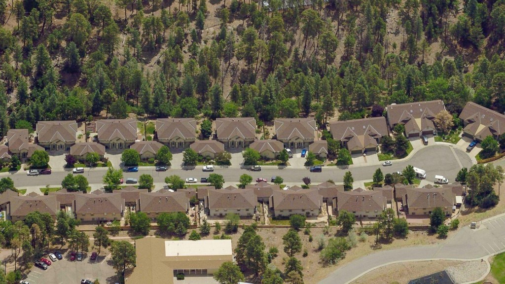
While orthogonal imagery may feel limited as it’s only top-down, it does provide helpful detail if the resolution is high enough. EagleView can deliver one-inch or sub-one-inch resolutions — offering granular detail that shows everything from landscaping details to fire hydrants to manhole covers. With high-resolution ortho and oblique imagery combined, assessors can get ultra-accurate property views.

1-Inch Imagery: See the Difference with Douglas County, NE
Watch as Mike Schonlau, GIS Administrator for Douglas County, NE, details the cross-departmental benefits of 1-inch imagery for his staff and residents and how to build a business case for it within your organization.
Sketch Verification: The Importance of Accurate Data
Wade explained how digital imagery has evolved from paper to the incredible digital detail we have today. 1995 was the first instance of accessing aerial photography on a computer in black and white. It wasn’t until 2008 that color was introduced, but even then, the images were one or two-meter resolution. When one-foot resolution came around, it helped immensely by providing the ability to zoom in and measure with slimmer margins of error. But the one-inch resolution introduced by EagleView in 2022 was the real game-changer.
EagleView’s one-inch oblique imagery has completely changed how assessors work. It saves enormous amounts of time and has dramatically improved data quality and accuracy. Wade also shared information about the IAAO standards for data accuracy and quality and explained why obtaining data of the highest quality is essential to meeting these standards and avoiding costly errors.
How Does Sketch Verification Work?
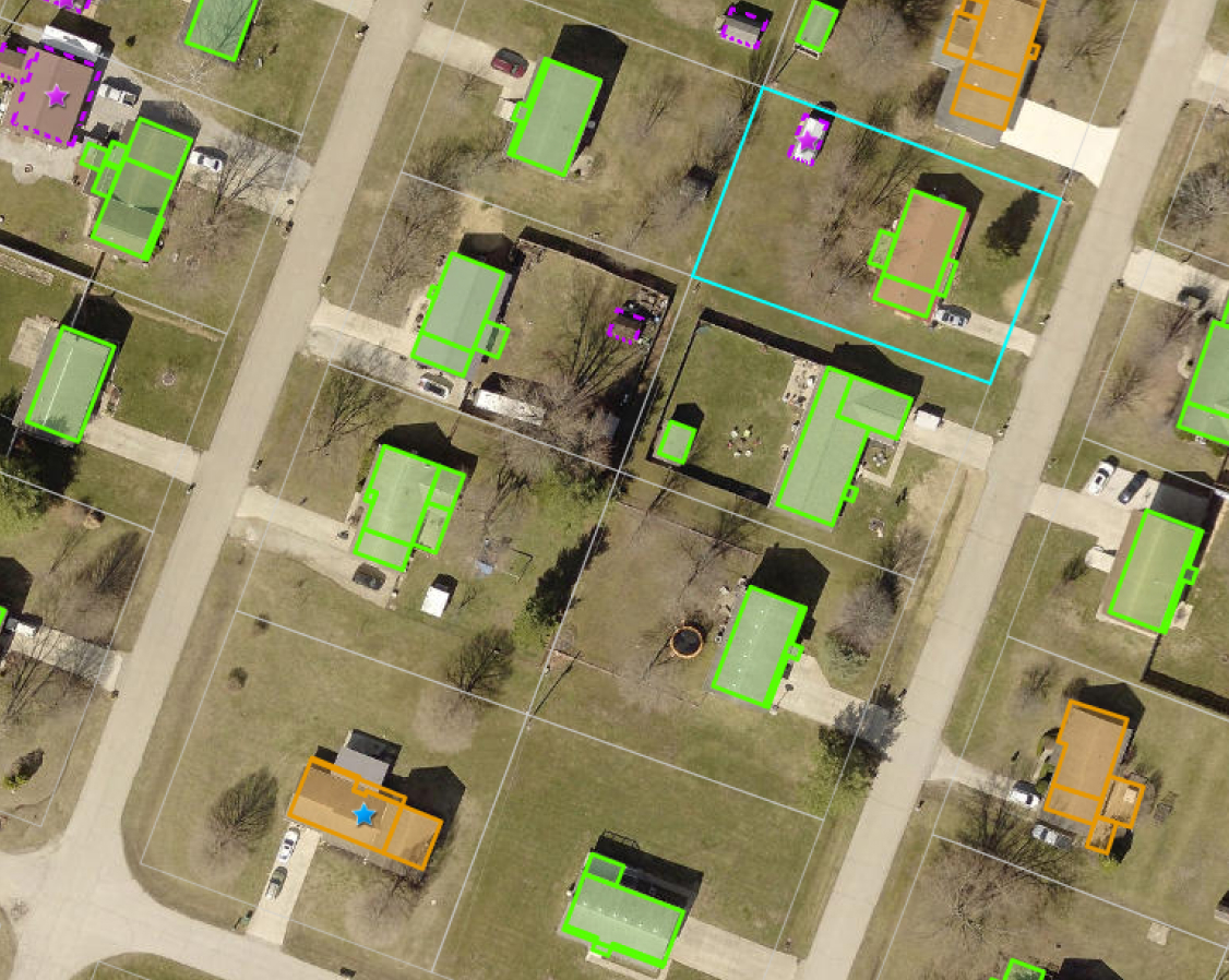
Property assessors maintain sketches for structures within their jurisdiction. Sketches show the overall building outline and can include dimensions and text to identify structural components like garages, patios, etc.
Sketch verification is a process that compares assessor sketches to building outlines extracted from high-resolution aerial imagery — identifying inaccurate and missing sketches, as Elliot explained. The process takes a building outline and superimposes it on top of a sketch to see if they match. Mis-matched sketches and building outlines may indicate that structures have been expanded or that new structures have been added to the property.
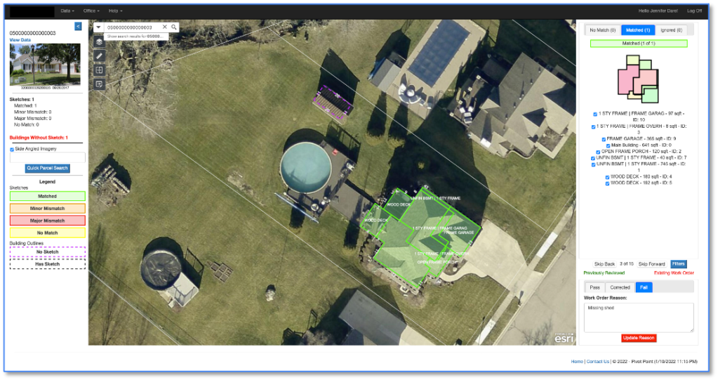
EagleView’s sketch verification solution Sketch Inspect uses geospatial technology and proprietary algorithms to reveal which sketches in the CAMA database are inaccurate and which may be missing. Sketch Inspect takes verification to the next level by comparing the entire data set in order to pick up on missing items. It allows assessors to identify which parcels need evaluation, which have small issues, and which have potentially major issues and require more attention.
The Bottom-Line Impact of Sketch Verification
Elliott shared incredible stats from Guernsey County, Ohio, where three users found the following after their first day reviewing results:
- 31 buildings reviewed
- $3,154,200 increase in appraised value
- $50,614 in additional tax revenue
At the time of the webinar, the County had discovered sketch issues on 805 parcels and estimates every hour spent reviewing Sketch Inspect results in an additional $3,000 in tax revenue.
Check out the full webinar to watch the demo and see how Sketch Inspect can deliver higher tax revenue for your jurisdiction.